Drainage Pattern
Drainage Pattern
Drainage:
- The flow of water through well-defined channels is known as ‘drainage’ and the network of such channels is called a ‘drainage system’.
Drainage Pattern:
- It refers to the system of flow of surface water mainly through the forms of rivers and basins.
- The drainage system depends upon factors such as slope of land, geological structure, amount of volume of water and velocity of water.
Types of Drainage Patterns
- Dendritic Drainage Pattern:
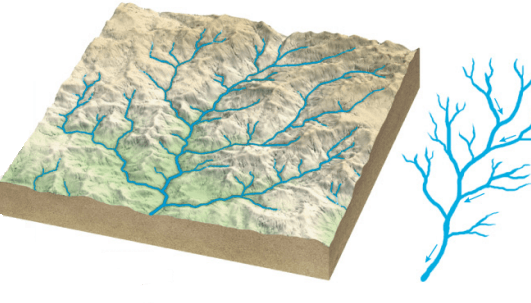
- It is the most common form and resembles the branching pattern of tree roots.
- The dendritic pattern develops where the river channel follows the slope of the terrain.
- The pattern develops in areas where the rock beneath the stream has no particular structure and can be eroded equally easily in all directions.
- Tributaries join larger streams at acute angles (less than 90°).
- E.g. The rivers of the northern plains; Indus, Ganga and Brahmaputra.
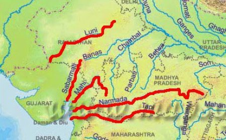
- Parallel drainage pattern:
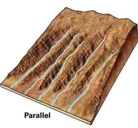
- It develops in regions of parallel, elongated landforms where there is a pronounced slope to the surface.
- Tributary streams tend to stretch out in a parallel-like fashion following the slope of the surface.
- E.g. The rivers originating in the Western Ghats; Godavari, Kaveri, Krishna, and Tungabhadra.
- Trellis Drainage Pattern:
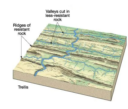
- Trellis drainage develops in folded topography where hard and soft rocks exist parallel to each other.
- Down-turned folds called synclines form valleys in which reside the main channel of the stream.
- Such a pattern is formed when the primary tributaries of main rivers flow parallel to each other and secondary tributaries join them at right angles.
- E.g. The rivers in the upper part of the Himalayan region; Indus, Ganga and Brahmaputra.
- Rectangular Drainage Pattern: The rectangular drainage pattern is found in regions that have undergone faulting.
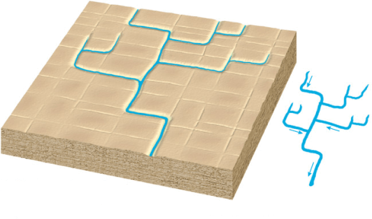
- It develops on a strongly joined rocky terrain.
- Streams follow the path of least resistance and thus are concentrated in places where exposed rock is the weakest.
- The tributary streams make sharp bends and enter the main stream at high angles.
- E.g. Streams found in the Vindhya mountain range; Chambal, Betwa and Ken.
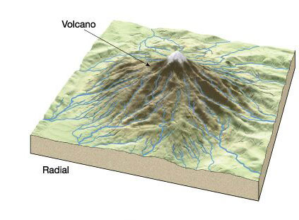
- Radial Drainage Pattern:
- The radial drainage pattern develops around a central elevated point and is common to conically shaped features such as volcanoes.
- When the rivers originate from a hill and flow in all directions, the drainage pattern is known as ‘radial’.
- E.g. The rivers originating from the Amarkantak range; Narmada and Son (tributary of Ganga).
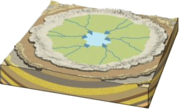
- Centripetal Drainage Pattern:
- It is just the opposite of the radial as streams flow toward a central depression.
- During wetter portions of the year, these streams feed ephemeral lakes, which evaporate away during dry periods.
- Sometimes, salt flats are also created in these dry lake beds as salt dissolved in the lake water precipitates out of solution and is left behind when the water evaporates away.
- E.g. Loktak lake in Manipur.
What's Your Reaction?